
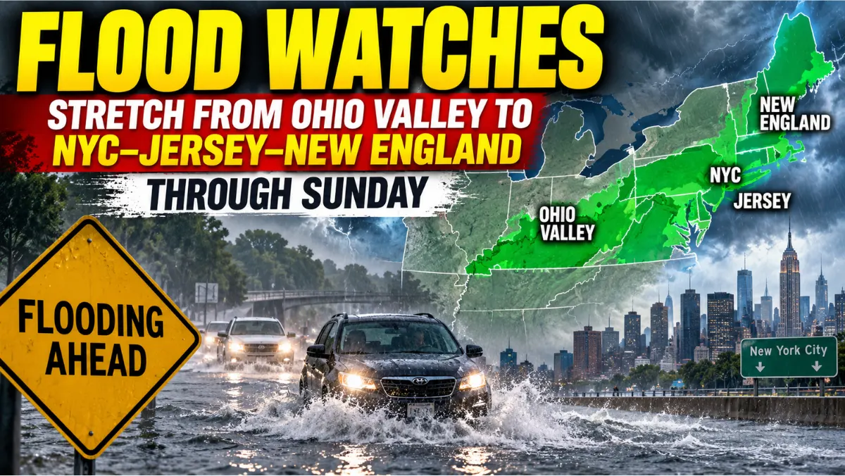
NEW YORK — National Weather Service flood watches blanketed a wide swath of the eastern United States on Saturday, stretching from the Ohio Valley through parts of Kentucky, West Virginia, and Pennsylvania into the New York–New Jersey corridor and on toward Rhode Island and southeastern Massachusetts through Sunday.
The pattern is not a single storm label so much as a chain of local Flood Watch products issued for saturated ground, expected rainfall, and the risk of flash flooding. Residents should treat watches as a planning signal: know your drainage-prone roads, move cars off low spots if advised locally, and avoid driving into water you cannot gauge.
Ohio Valley and Appalachian watches
NWS Wilmington, Ohio, had a Flood Watch in effect from 8 a.m. EDT Saturday through the evening for portions of Kentucky—including Bracken, Lewis, Mason, and Robertson counties—and a long list of Ohio counties that includes Adams, Brown, Fairfield, Franklin (the Columbus area), Highland, Hocking, Licking, Pickaway, Pike, Ross, and Scioto. Forecasters cited already saturated soils and the potential for flash flooding.
Farther south and east, NWS Charleston, West Virginia, held a watch from noon EDT Saturday through late tonight covering northeastern Kentucky, southeastern Ohio, and large parts of West Virginia, including the Kanawha/Charleston and Cabell/Huntington areas. NWS Pittsburgh’s product, also noon through late tonight, took in east-central Ohio, western Pennsylvania including the Allegheny/Pittsburgh metro, and West Virginia panhandle counties. NWS Jackson, Kentucky, likewise carried watches for eastern Kentucky counties in the same regional setup.
Inland watches matter even outside classic floodplains: creek bottoms, underpasses, and fields can rise quickly on saturated soils.
Mid-Atlantic into New York City
Closer to the coast, NWS Mount Holly, New Jersey, extended a Flood Watch from late tonight through Sunday morning across northern Delaware (New Castle County), much of New Jersey—including Morris, Hunterdon, Mercer, Middlesex, Monmouth, Camden, and Ocean counties—and southeastern Pennsylvania counties that include Philadelphia, Montgomery, Bucks, and Delaware.
NWS New York said late tonight through Sunday morning covers northeastern New Jersey counties (Passaic, Bergen, Hudson, Essex, and Union), the New York City boroughs, and southern Westchester. The New York product pointed to roughly 1–2 inches of rain with peak hourly rates near 1.5–2 inches. Separate Long Island and Connecticut portions of the New York office’s messaging ran late tonight into Sunday afternoon, with locally 3–5 inches possible in parts of that Long Island/Connecticut product area.
For a metro region that already tracks transit and airport disruption during heavy rain—see recent Labor Day airport delays and debates over air traffic controller staffing and pay—even a short intense burst can stall buses, flood subway stairs, and close parkways.
New England edge
NWS Boston/Norton carried a Flood Watch from very late tonight through Sunday afternoon for Rhode Island and southeastern Massachusetts. Guidance there included about 0.5–2 inches widespread, with narrow bands of 2–4 inches possible.
That New England fringe is a reminder that flood-watch geography hops state lines even when county-average totals look moderate. Localized bands turn a wet Sunday into street flooding.
How to use a flood watch (without panic)
A Flood Watch means conditions favor flooding—not that your address is already flooded. A Flood Warning means flooding is occurring or imminent. Monitor county alerts, never drive through standing water, and check basements or sumps that need attention.
National products and local office text are posted through weather.gov; a national Flood Watch text bundle is available via the NWS Flood Watch product page. Always prefer the product for your county over a social-media map screenshot.
Post-disaster debates such as Helene FEMA reform show why early preparedness beats late heroics. Long-range projects like the Interborough Express are about ordinary-day mobility; flood watches are about the next 36 hours.
Why this matters
Saturday’s watches stitch the Ohio Valley, Appalachia, the Philadelphia–New Jersey corridor, New York City, and parts of New England into one message: treat overnight and Sunday morning as elevated flood risk on already soaked ground. Commuters, overnight workers, and basement households have the most to lose from a bad underpass decision. Stay off flooded roads and share only official NWS or local emergency links.
How Never Late News reported this
Never Late News summarized National Weather Service Flood Watch products available Saturday morning, Sept. 12, 2026, from the Wilmington OH, Charleston WV, Pittsburgh PA, Mount Holly NJ, New York NY, Boston/Norton MA, and Jackson KY offices, including listed counties, valid times, and rainfall guidance stated in those products. We did not invent rainfall totals, county lists, or watch end times beyond those products. Watches can be expanded, cancelled, or upgraded to warnings—recheck weather.gov for your county before travel.
Corrections and reader feedback
If you spot an error in this report, email tips@neverlatenews.com. We correct the record promptly and note substantive updates at the bottom of the story when needed.